Much of northern Santa Barbara County is covered in wilderness areas. The land has a remote feel, towns are scarce, roads are often washed out, closed, or flooded. In prehistoric times, the native Americans that lived here left behind a legacy of rock paintings on sandstone formations. The area has an allure for me, and I discovered a love for wild places here, as a student when I first moved to California. Distances are vast, “roads” are unpaved and often closed to motor vehicles, and the most reliable mode of transportation is by mountain bike.
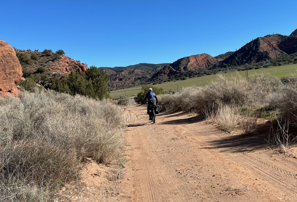
This peak is south of Cuyama lookout. Those with jeeps or very high clearance 4x4s could drive to Cuyama lookout when the road is opened. I don’t believe I would be able to drive our Subaru Forester there. The route begins in Santa Barbara Canyon. In the winter & spring, the Cuyama river can flood from rains so the forest service closes the gate at the Santa Barbara Canyon Ranch. From there it is about 3.5 miles to the junction with forest road 7N04, Dry Creek Road. The road climbs 2000 feet in 6 miles to the top of the Tinta OHV trailhead, which borders the Dick Smith Wilderness. From the gate at the Santa Barbara Canyon Ranch, Mike K6STR & I bikepacked in with camping gear to Cox Flat, about 5 miles up the road. We expected to see some water given how much rain fell this fall, but there was none. A small stream was flowing at the beginning of the Big Pine road/trail, so we knew we could get water there in a pinch if we didn’t encounter anymore the next day. The route to Tinta Ridge was going to be a long day out on the bikes, so camping near the bottom of the Dry Creek road made sense. We carried enough water in to make it to the peak the next day. We saw two E-bikers riding down in the dark, having ridden to Big Pine Mountain and back – a long day!
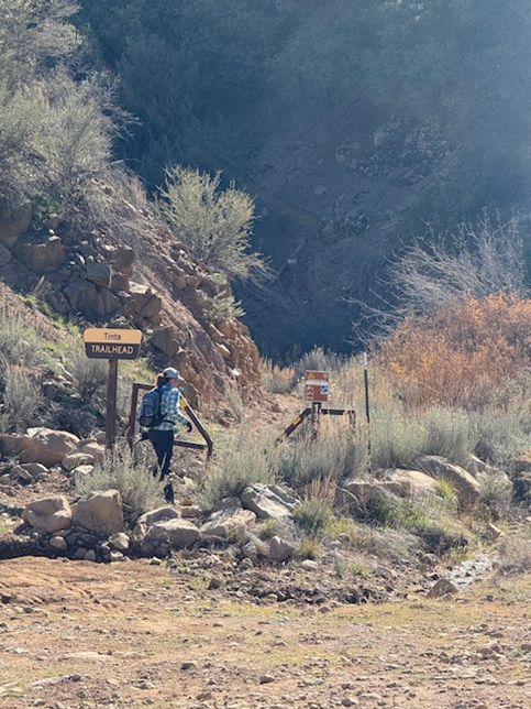
On Sunday we packed our day-gear and water and started riding up Dry Creek road. The first dry stream crossing would have been a challenge in the Subaru. The road was beautiful, but soft from being closed and not driven on for a month. It took 2 hours to make the climb to the top of the Tinta OHV trailhead, where we stashed bikes and put on long pants and shirts for the bushwhack to Tinta Ridge. We noticed a trickle flowing in Tinta Creek near the gate – this would help us immensely at the end of the day.
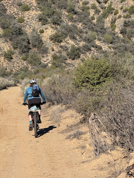
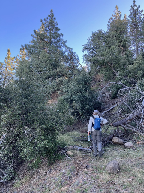
Around noon we started hiking on the Tinta OHV trail which was boulder strewn, for 1/3 of a mile. We followed the Sierra Club Hundred Peaks Section route 4 for Lizard Head Peak https://hundredpeaks.org/guides/06e.htm to the Tinta Ridge. The bottom of the route had burned and regrown, and there were many downed sycamore trees to navigate. While the route up was only about 1.5 mi and ~1400 ft up, it took about 45 minutes to gain 200 feet on the correct ridge while we picked our way up, down, around and through the brush and dead branches. From there though, we located the old trail/road, which was very overgrown, but marked with occasional beer cans and whisky bottles. While trash, they did indicate we were going the right way, so we left them. The route up was soft, and the main plant was chamise, which is easier to push through than ceanothus. The spiky ceanothus plant was there, it was just small and could be walked around. We didn’t have to crawl under anything – a major win! The ridge became more scenic although the footing was soft and demoralizing, always pushing through chamise, sliding back with each step. Finally with about 500 ft to go, we came upon on a switchback of a wider old roadbed, and found ourselves in a forest of Coulter pines. This made the last part of the peak the nicest.
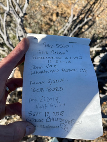
Eventually we reached the final highpoint and found a small jar with a summit register in a pile of dead manzanita branches marking the peak. I pulled out my Yaesu VX-6R, called out on 146.52 and got a guy in Lemoore in the Central Valley! He was nice and tried to drum up business for me on the local repeaters, but being a Sunday afternoon, traffic was quiet. We chased KD7DTS on the Sandia Crest in NM for an S2S with our KX2. 20m, 40m, and 15m were productive. Mike K6STR reached New Zealand and Japan.
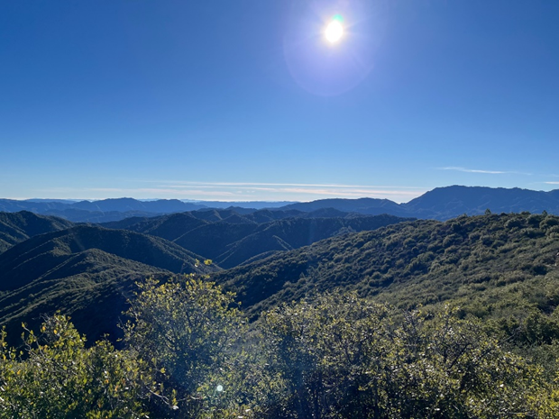
From this peak, there’s a unique view of the Pacific Ocean to the west and the snow of the Southern Sierras to the east. Also, looking north, Cuyama Lookout and Caliente Mountain (which we biked to earlier this summer) stood like sentinels. By 3:15 it was time to pack up. It took 2 hours to reach the peak on foot, but fortunately, was much quicker to descend, having found the correct ridge. We made it down to Tinta Creek by 4:30 and were able to fill all of our water bottles with the tiny flow from Tinta Creek, dropping in Aquatab purification tablets to carry 3.5 liters back to our camp. This would serve as our dinner and breakfast water (whew!)
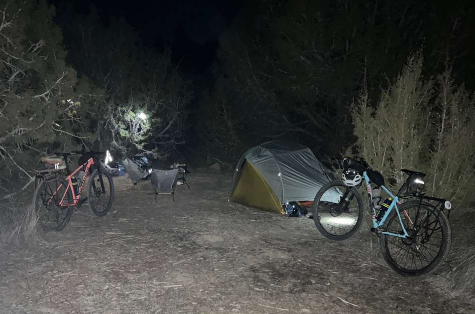
Biking back in the sunset and eventual darkness with bike lights was surreal. The area was very remote and at one point, two blue eyes reflected in my bike light, coming toward me at a trot. It was a canine, and small – it kept coming then darted away, swooshing its long tail. I believe it was a fox, because it looked smaller than a coyote. Nearby is Fox Mountain, perhaps named this for a reason. We made it back to camp at 6:15, grateful for no flats or mishaps, collapsed in the tent, and eventually went to boil some water for a rehydrated bowl of Pho soup. The night was clear, 32F, and breezy save for the stand of junipers we were protected in, and the stars were bright. It is hard to find a quieter place!
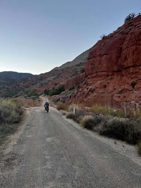
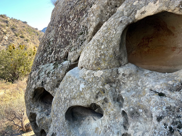
The next day we packed out and started the short ride back to the trailhead. We stopped to explore some interesting rock formations along the way, and found a Chumash cave with paintings in it. The opening was pretty small - I wondered who sat there in that small space, painting, hundreds of years ago, and what they were trying to communicate on those rock walls.
I really enjoy every trip to the Los Padres National Forest – SOTA gives me an excuse to keep coming back again and again.