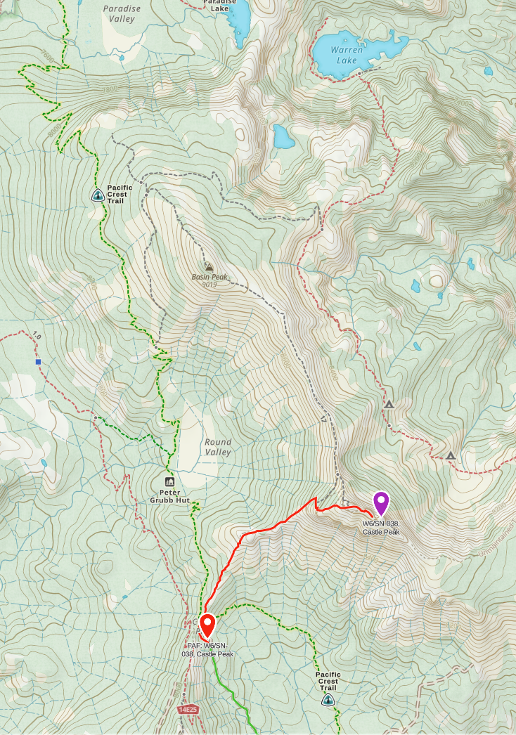
Take exit 176 from I80 and drive or park on Castle Valley North road as far as you want to go. Most people park at the Castle Peak TH at 39.34047192340203, -120.34777634631043, the more adventurous will go all the way to the parking area near the PCT. From the TH it\'s only 1.7 mi to the PCT at Castle Pass. At the pass turn on the steep use trail. Castle Peak actually has three peaks, the furthest southeast peak is the SOTA summit. The AZ starts at the third peak base so that you don\'t have to get into the technical area at the top which puts you possibly into class-3 hike. The steepness of the SOTA summit peak challenges the AZ algorithms on SOTLAS, the AZ shown on SOTLAS is way oversized and inaccurate.
Dan, AI6XG, likes to hike along the saddle north to Basin Peak and then back down to the PCT for the return. This way has epic views of Warren and Paradise Lakes, several other SOTA summits and the valley below. It has some steep sections but less than returning directly from Castle Peak. But it does add a couple hours to your journey
The use trail gpx can be downloaded below.
Originally created by N1CLC from notes from Dan.